When the Map Lies: Why AIS Trust Matters in Contested Waters
Follow ML-Affairs On LinkedIn
Open the ML-Affairs page and follow it directly, or use the LinkedIn widget below.
Publication note: this article was first published through Vortexa on Medium as When the Map Lies: Why AIS Trust Matters in Contested Waters. This ML-Affairs version is my author republication of that Vortexa-led publication.
In calm periods, vessel tracking can look deceptively simple.
A ship emits AIS. A platform collects those positions. A map draws a line. An analyst sees where the vessel is going.
That mental model breaks the moment geopolitics enters the water.
I have spent enough time around streaming systems to know that bad data rarely fails politely. It usually arrives looking plausible enough to be trusted, and by the time someone notices, it has already shaped a downstream decision.
That is why this problem matters to me.
When the Strait of Hormuz becomes contested, when the Red Sea becomes a security problem, when sanctions pressure grows around opaque oil movements, the vessel track is no longer just a technical artifact. It becomes evidence. And evidence can be incomplete, manipulated, delayed, spoofed, or deliberately made ambiguous.
That is the world energy markets now operate in.
The Strait of Hormuz remains one of the world’s most important oil chokepoints. The U.S. Energy Information Administration, using Vortexa tanker-tracking data, estimates that oil flows through the strait averaged about 20 million barrels per day in 2024, while the International Energy Agency describes it as a route with limited bypass options and major consequences for world oil markets if disrupted. Vortexa has also publicly analysed how Red Sea risk changes oil, gas, and tanker-market behaviour, and how tanker diversions can alter voyage duration, freight, and route economics.
When conflict, attacks, sanctions pressure, or navigation interference touch those routes, the question is not abstract. It affects crude flows, LNG flows, sanctions exposure, freight risk, pricing, and the confidence with which traders and analysts can explain what is happening.
The hard part is not putting vessels on a map.
The hard part is knowing when the map deserves to be believed.
That is where Vortexa’s value becomes easiest to understand.
Not as a company that merely displays vessel data, but as a company that turns messy maritime signals into trusted intelligence about how energy moves through the world.
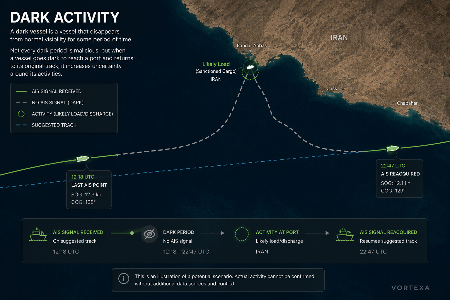
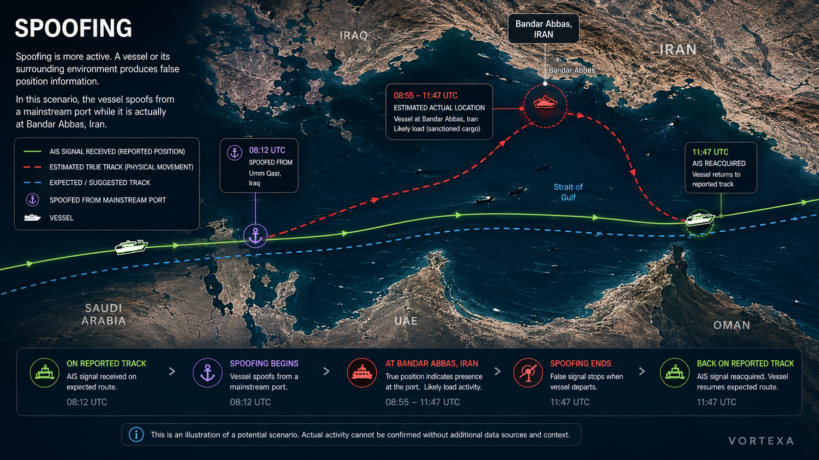
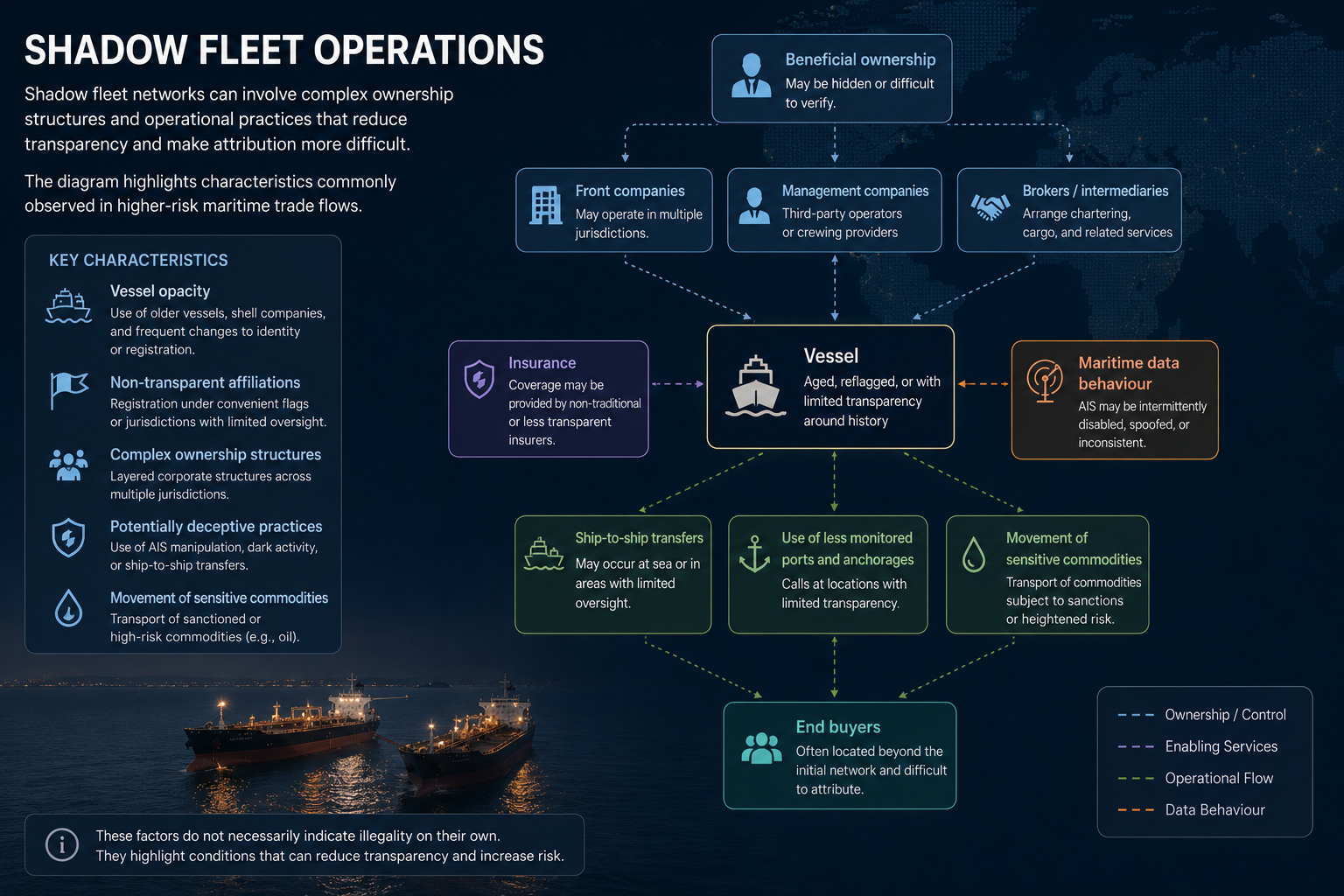
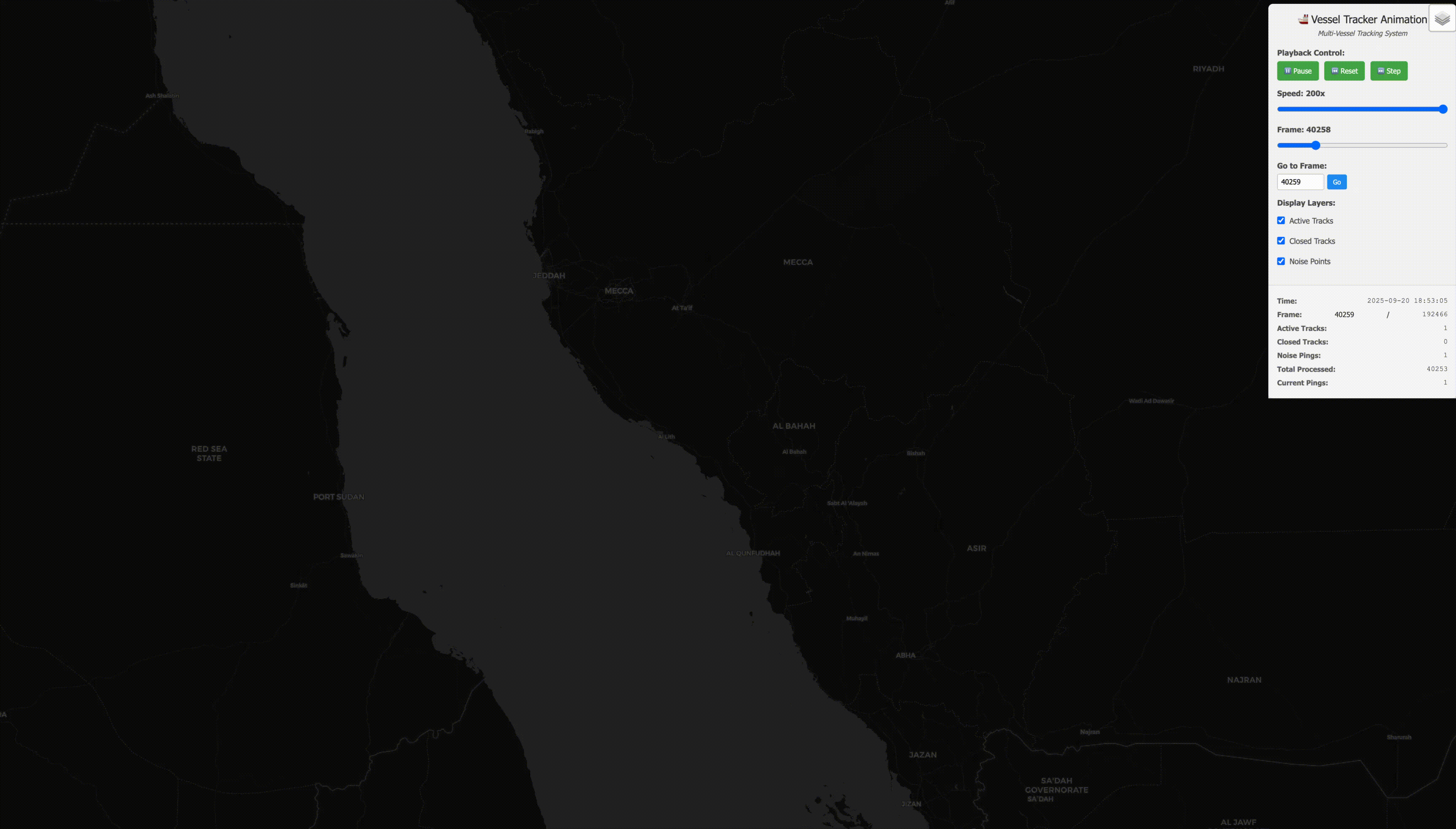
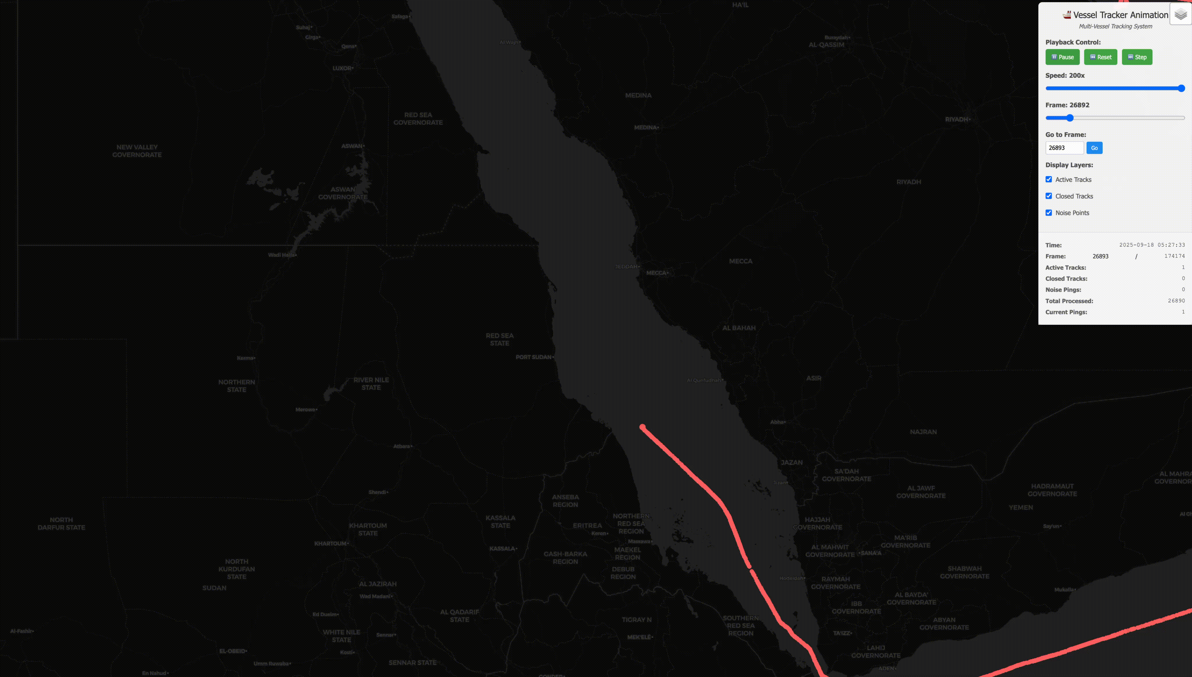
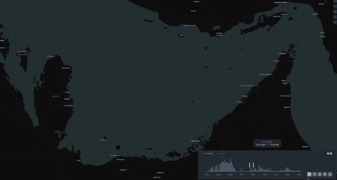
Visual note: the illustrative images in this article are AI-generated synthetic diagrams used only for explanation. They are not evidence of actual vessel activity, cargo movements, port calls, ownership structures, sanctions status, or wrongdoing by any real vessel, company, port, or state.
The New Vocabulary of Maritime Risk
If you work near maritime intelligence today, a few terms keep appearing.
A dark vessel is a vessel that disappears from normal visibility for some period of time. Sometimes that is benign: coverage gaps, equipment issues, or legitimate operational constraints. In higher-risk contexts, though, going dark can help hide port calls, route changes, ship-to-ship transfers, or cargo movements.
Spoofing is more active. A vessel or its surrounding environment produces false position information. The ship may appear somewhere it is not. It may seem to move across land, sit inside a port it never entered, or trace physically absurd paths. Scientific American has described how GPS spoofing in the Strait of Hormuz can cause AIS-derived vessel locations to show impossible movements, while U.S. Treasury maritime guidance warns that deceptive shipping practices can include disabling or manipulating AIS.
A shadow fleet is the broader operating model. It usually refers to networks of vessels, owners, flags, insurers, intermediaries, and cargo movements designed to move sanctioned or opaque commodities while making attribution difficult. The U.S. Treasury’s maritime oil advisory explicitly warns that shadow-trade actors can conceal ownership and manipulate or disable AIS, and OFAC has continued to sanction vessels and managers linked to Iranian shadow-fleet activity.
These are not exotic edge cases anymore.
They are part of the operating environment for energy intelligence.
Hormuz Makes The Problem Concrete
The Strait of Hormuz is a clean example because it connects the technical problem to a market consequence immediately.
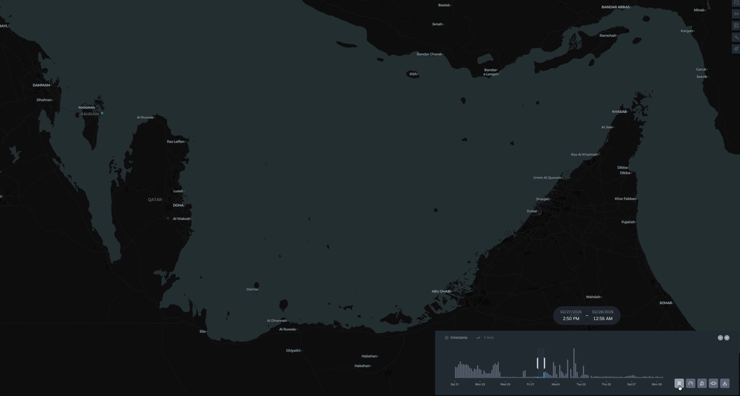
When the region is calm, a vessel track through Hormuz is a line through a chokepoint.
When the region is under pressure, that same line becomes a claim about whether crude is moving, whether LNG is delayed, whether a sanctioned vessel crossed, whether a cargo is stuck, whether a tanker turned back, and whether the market should price disruption or resilience.
Public reporting in recent years has repeatedly surfaced categories of concern around attacked vessels, suspected spoofing, identity manipulation, opaque ownership, and sanctions-linked movements. We do not need to reproduce each vessel case inside this article to see the engineering lesson.
Each story asks a different operational question.
An attacked or disrupted vessel asks: where was it, what route did it take, what traffic was nearby, and what flows were affected?
A spoofing concern asks: where did the vessel say it was, where was it likely to be, and what evidence contradicts the reported position?
An identity concern asks: which identity is being used, whether that identity makes sense, and what physical vessel is actually moving cargo?
A shadow-fleet transit asks: whether a vessel crossed a chokepoint, changed behaviour, approached a terminal, performed a ship-to-ship transfer, or appeared in a suspicious location at the wrong time.
This is exactly where clean signal becomes commercial intelligence.
AIS Is A Claim, Not A Fact
The most important mental shift is simple:
Every incoming AIS position is a claim about reality.
Some claims are routine. Some are incomplete. Some are stale. Some are physically implausible. Some are probably generated by equipment or coverage problems. Some may be deliberately deceptive.
A serious maritime intelligence platform cannot treat all of those claims equally.
It has to ask questions before allowing a position to shape downstream interpretation:
- Is this position plausible given the vessel’s recent movement?
- Does the point sit somewhere a vessel can physically be?
- Does the signal behaviour match the region’s known risk profile?
- Does the position agree with other signals, or does it look isolated?
- Does the source type, timing, and repetition pattern make the point more or less trustworthy?
- If we reject this point, can we still preserve enough evidence for analysts and systems to understand why?
That last question matters.
The goal is not to hide uncertainty. The goal is to structure it.
What Vortexa Adds
At Vortexa, the challenge is not simply to ingest more maritime data.
The challenge is to make that data decision-grade.
Energy-market users do not care about raw pings for their own sake. Vortexa’s public tanker-tracking material frames the customer value in exactly these terms: flows, origins, destinations, cargo, route changes, and ship-to-ship transfers. They care about the questions those pings support:
- Is oil moving through the Strait of Hormuz or waiting outside it?
- Did a vessel actually call at a port, or did it only appear nearby?
- Is a cargo delayed, rerouted, hidden, or transferred?
- Is a flow disruption real, temporary, or an artifact of broken tracking data?
- Are sanctions-linked vessels behaving differently from ordinary commercial traffic?
- Can we explain the answer clearly enough for a trader, analyst, risk team, or customer workflow to trust it?
That is the commercial value of signal cleaning.
Not cleanliness for its own sake.
Cleaning because every bad vessel position can leak into a bad market story.
Here is the chain I worry about.
A spoofed position suggests a tanker crossed Hormuz. That false crossing feeds a port-call inference. The port-call inference feeds a cargo movement view. The cargo movement view feeds a flow estimate. By the time the error reaches the analyst, it no longer looks like a bad ping; it looks like a market fact.
That is the failure mode a serious trust layer has to prevent.
The Trust Layer
The safest public way to describe the work is this:
Vortexa builds a trajectory validation layer between raw maritime signals and the products that depend on them.
That layer combines several kinds of judgment.
First, there is immediate signal validation. Some positions are suspicious without needing much history. They may fall on land, appear in known problematic areas, repeat in ways that suggest stuck equipment, or come from patterns that should not be allowed to contaminate downstream analytics.
Second, there is trajectory-level validation. A vessel has a recent story: its speed, heading, timing, route, and prior positions. A new point should strengthen that story, challenge it, or start a competing explanation. It should not automatically become truth because it arrived most recently.
Third, there is geography-aware posture. The same kind of irregularity does not mean the same thing everywhere. Sparse coverage in one region may call for patience. Heavy spoofing risk in another may call for stricter confirmation. A global system has to adapt to the operating environment without exposing brittle manual logic to every downstream user.
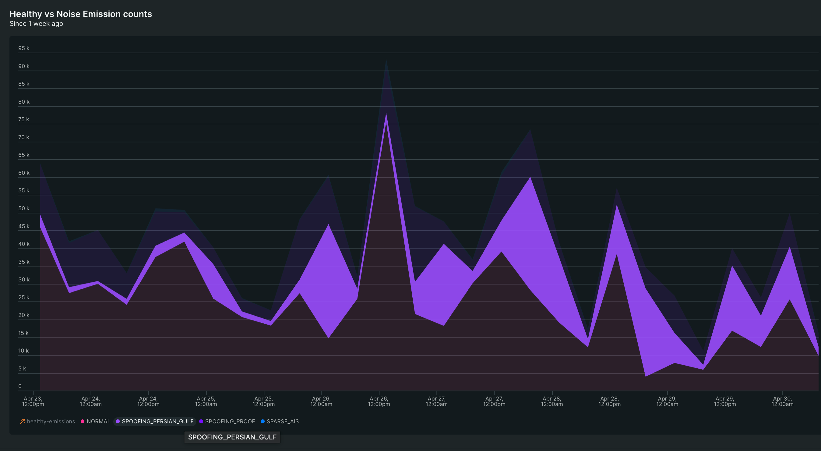
Fourth, there is observability. If the system distrusts signals more often in a specific region, analysts and engineers need to see that. A spike in suspected spoofing or sparse AIS behaviour is not just a data-quality note. It is part of the geopolitical and operational picture.
This is where the work becomes more interesting than “filtering.”
A basic filter removes bad points.
A trust layer preserves the difference between a healthy track, a suspicious claim, a competing trajectory, a sparse-coverage region, and a spoofing-prone environment.
That distinction is where downstream intelligence gets stronger.
Why This Is An ML Systems Problem
It would be tempting to describe this as a set of rules.
That would be misleading.
Rules matter. Deterministic checks are useful. There are obvious cases where a point should be challenged immediately. A ping on land should not be treated casually. Terrestrial AIS reception has physical characteristics; a coastal receiver cannot plausibly receive a normal signal from arbitrarily far away. These simple constraints matter.
But the valuable part is not a pile of if-statements.
The valuable part is the system’s ability to maintain a stateful view of vessel movement under uncertainty.
In practice, that means the platform needs to classify emission quality, associate observations with the right trajectory, score anomalies, calibrate confidence by region, and learn from analyst-reviewed cases. A vessel may have one coherent main trajectory and another suspicious sequence of points that should not yet be trusted. The system has to decide when a new signal belongs to the trusted path, when it should be buffered, when it should be isolated as noise, and when enough evidence has accumulated to change the story.
That is not a cosmetic map problem.
That is an applied machine-learning and systems problem:
- state needs to be maintained per vessel
- uncertainty needs to be represented explicitly
- signals need to be scored against physical plausibility
- suspicious tracks need to be separated from trusted tracks
- confidence needs to be calibrated for different regions and source behaviours
- decisions need to be explainable enough for humans and downstream systems
- the system needs to keep working at global scale, continuously
The value is not that the system draws a smoother line.
The value is that it prevents a false line from becoming a false market conclusion.
What the Gulf Examples Show
The Gulf region makes this less theoretical.
In a dense and sensitive region, the raw signal can contain both the movement we care about and the noise that would mislead downstream systems. Some emissions belong to coherent vessel movement. Some should be challenged. Some should be kept visible as evidence without being allowed to become the trusted story.
That is why the distinction between displaying data and validating data matters.
A sparse period in one region, an isolated jump in another, and a cluster of suspicious emissions near a chokepoint do not carry the same meaning. Treating them as identical would be operationally lazy.
The system has to preserve enough uncertainty to avoid overclaiming, while still being decisive enough to keep bad evidence from contaminating the product.
Customers should not have to know every reason a ping was rejected. They should be able to trust that the platform has disciplined ways of separating movement, noise, uncertainty, and context before the answer reaches them.
Why Vortexa Matters Here
There is a reason this work belongs in an energy intelligence company, not just a vessel-tracking demo.
The end product is not the point on the map.
The end product is the interpretation built on top of that point:
- flows by origin and destination
- port calls
- cargo movement
- congestion and disruption
- sanctions exposure
- market balances
- regional risk
- trade-route behaviour
If the vessel track is wrong, those higher-level products inherit the error.
If the system cannot separate a spoofed track from a plausible one, the analyst gets a confident fiction.
If the platform cannot see the difference between sparse coverage, deliberate deception, and real movement, then the market story becomes fragile exactly when customers need it most.
That is the value Vortexa provides: a cleaner, more defensible view of reality when reality is being actively obscured.
Closing Thought
In contested waters, vessel tracking is not a map problem. It is a trust problem.
And trust is not created by one algorithm, one data source, or one clever filter.
It is created by a full intelligence stack: raw signal ingestion, validation, stateful trajectory reasoning, regional context, observability, analyst feedback, and market-aware interpretation.
That is why AIS cleaning matters.
Because in a world of spoofing, dark vessels, shadow fleets, and geopolitical disruption, the companies that understand oil and gas flows best will be the ones that know when the signal deserves to be believed.
A vessel track is not valuable because it is drawn.
It is valuable because it has earned the right to be trusted.
Further Reading
- U.S. Energy Information Administration, Amid regional conflict, the Strait of Hormuz remains critical oil chokepoint
- International Energy Agency, Strait of Hormuz factsheet
- Vortexa, Quick Q&A: Red Sea risks for oil, gas and tanker markets
- Vortexa, Tanker diversions rise on Red Sea tension
- Vortexa, Tanker tracking: The foundation for oil market intelligence
- Vortexa, Oil in supply chain explains muted price reaction to shocks
- Scientific American, Why ships in the Strait of Hormuz can’t trust their navigation screens
- U.S. Department of the Treasury, Price Cap Coalition Advisory for the Maritime Oil Industry and Related Sectors
- U.S. Department of the Treasury, Treasury Maintains Pressure on Iranian Shadow Fleet